Photo © Arquine
Mexico City’s Gordian knot
|
|
by Alejandro Hernández Gálvez
Mar 18, 2014 In the 16th century Mexico City and Venice had something in common: both where representative and powerful cities built into the water. Almost five centuries later, both still have to deal with water problems. But if Venice is still a collection of islands in a lagoon, with a population of little more than 270,000 people —only 60,000 of whom live in the historical city of Venice— in Mexico City almost every last lake and river has been laid dry and its population has grown from the million it had in the 16th century (when it was one of the largest cities in the world) to almost 20 million in the present metropolitan area. At 2,240 meters above see level, water management, both supply and drainage, is not the only major problem the megalopolis faces. It is joined by transport, housing, air pollution, waste management, probably everything a city with a population of such a size has to worry about. Model for Venice In the 15th century Mexico City, known then as Tenochtitlan or “Temitistan”, was included in the “Atlas of the “World” drawn by Battista Agnese, one of the most important cartographers in the Venetian republic, as the biggest city. Cultural geographer and author Denis Cosgrove mentioned in his book “Mapping New Worlds: Culture and Cartography in Sixteenth-Century Venice” that it was also represented with equal prominence in Giovanni Battista Ramusio’s maps of 1534 and 1556 and that the oldest map of “La gran citta de Temistitan”appears in 1528 “Isolario”, by Benedetto Bordone. Cosgrove explains that there was a “shared fascination among both Venetian cartographers and thinkers with Mexico City.” Venetians considered “Temitistan” as exemplary: Girolamo Francastoro, physician, mathematician and cosmologist, “proposed the transformation of Venice into a new Temestitanisolated in a river-fed fresh water lake.” Another problem Mexico City has to deal with is that addressed by Venetian cartographers in the 16th century, namely its representation, both cartographical and political. Public and informal transport systems For instance, Mexico City’s transport system was not represented 500 years ago, when the city was surrounded by water. And today it likewise seems impossible to draw it and by extension to comprehend it, given the infrastructural challenge of a transport system which includes both public and private owned vehicles that are informally used as public transport. The public sector system includes more than 225 kilometers of subway with 12 lines and 195 stations; a bus rapid transport system (BRT) 105 kilometers long and consisting of five routes and 150 stations; 93 bus lines, 8 trolleybus lines and one electric train line. It also counts with 4000 bikes in 276 stations in a privately run sharing system in some central neighborhoods. Yet 60 percent of daily travel involves one of the more than 28,000 privately owned buses and “microbuses”operated with almost no governmental regulation —many of them are run on a simple driver/owner model. Needless to say, there is no comprehensive cartographical representation of this complex system of practically autonomous systems. Whereby the latter complex only refers to less than half of the metropolitan area of Mexico City: the Federal District. Because it is there that the other representational problem likewsie comes to the fore: political representation. No political structure for long time planning The Federal District is divided into 16 boroughs, some with a little more than 130,000 inhabitants and others, like Iztapalapa, with almost two million, while Mexico City Metropolitan Area includes 40 municipalities of the State of Mexico, some with 40,000 inhabitants or so, others, like Ciudad Neza, with more than a million. The problems with the complex political organization of the metropolitan territory relate not only to living in a municipality potentially ruled by one party in a state ruled by another, while you may quite possibly go to work everyday in a borough and a city ruled by a third one. For the key issue is not only politics but first and foremost policy. As re-election is prohibited for municipal or borough representatives (they remain in their posts for only three years), there is not enough time for long-term planning; moreover such individuals view their work as a step up a political career ladder. Even for state governors or the city mayor, who cannot be reelected either, but whose term in office is six rather than three years, their position is also taken as part of a longer career, specially in the State of Mexico and Federal District —the current president was Governor of the State of Mexico and there are former mayors of Mexico City who where strong contenders. The same goes for local and federal congresses, which means that, for instance, on one side of the street (.e.g., the Federal District side, which is more liberal and has been ruled by the leftist PRD party for 16 years now) abortion and same-sex marriage are legal while on the other side of the street they are not. Such a state of affairs is surely more complicated than the taxi or bus rates that likewise differ from one side of the street to the other. Model needed Just as there is no comprehensive cartographical representation of its manifold public and private transport systems of the metropolitan area of Mexico City , it also lacks a comprehensive political representation and its corresponding policies. In a way, the metropolitan area of Mexico City has not created an image of itself and needs some kind of model, in the same way as 16th century Venice relied for guidance on the then newly discovered Temistitan. Of course that model of political and strategic organization cannot derive from a single contemporary city in a modern world atlas. |
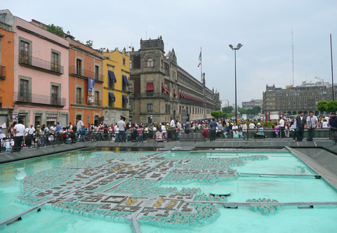
Model of Tenochtitlan, located at the Lake Texcoco. Photo © flickr / -chupacabras- 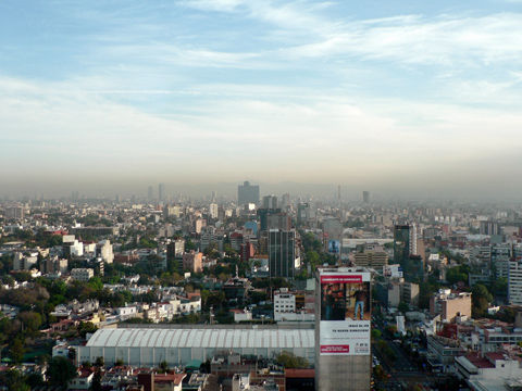
Because if its topographic situation, the city has a heavy smog problem. Photo © flickr / el ranchero 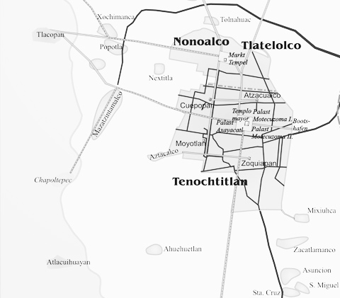
Systematic map of Mexico City. Photo © Wikipedia / HJPD 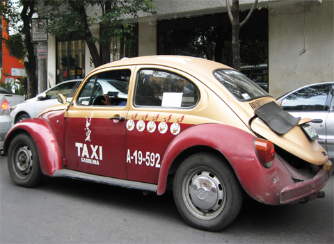
A typical taxi in Mexico City. Photo © Volker Kleinekort 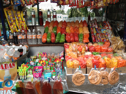
At kiosks on the roadside the Mexicans provide themselves with the foods that belong to their daily needs. Photo © Volker Kleinekort 
Kiosks like this are part of Mexico Citys streetscape. Photo © Volker Kleinekort 

|
